Large scale deforestation due to subsistence farming and industrial purposes has posed a serious threat to the existence of mankind and other living creatures on earth. To counter this trend, there has been a strong voice from powerful activists. But the most important contribution to any significant reversing of this process is coming by way of technology.
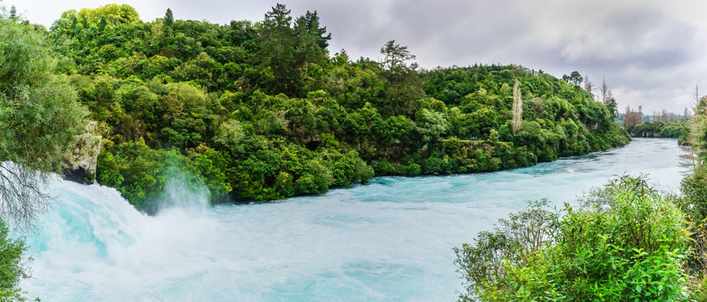
Rainforests are the earth's oldest ecosystems. They cover only six percent of the earth's surface, yet but have more than half of the world's plant and animal species. They are dense with tall trees. The name rainforest is coined due to the high amount of rainfall it gets every year. Today, innovative methods like using an arborist can help us conserve rainforests, but they aren’t the only method.
The Threat of Deforestation
Deforestation of this vast source of oxygen jeopardizes the atmospheric balance of the world. It increases the percentage of toxic substances like carbon dioxide, sulfur dioxide and nitrogen dioxide in the air while decreasing that of oxygen required for breathing. Industrial pollution also increases the content of harmful hydrocarbons.
Now, to understand the role of technology in the conservation of rainforests, we can classify it under three categories:
1) Scientific Discovery
2) Monitoring & Enforcement
3) Communication
Scientific Discovery
Thanks to advanced remote sensing technology, we have been able to identify new habitats for flora and fauna. Google Earth is used to a wide extent for discovering new species living there.
Tropical rainforests are found in South America, West Africa, South East Asia, and the Pacific Islands. Temperate rainforests are another type of rainforests found along some coasts in temperate zones.
Monitoring & Enforcement
Drones are great when it comes to surveillance. Satellite imaging systems also check the reason and amount of degradation happening there. The government and statutory bodies bestowed with relevant responsibilities, carry out enforcing laws and circulating warnings to the offending parties. Here, community mapping by way of GPS, marking of wildlife by RFID tags and setting up of alert systems like Rainforest Connection Project is also done.
Mass-scale burning of peatlands in Indonesia has resulted in a devastating environmental impact in and around its borders. Mr. Joko Widodo, the president of Indonesia, has called on the universities and tech innovators of South East Asia for possible solutions to the problem.
In Singapore, pollution measurement apps and air purifiers are used along with masks on top of some buildings for measuring and decreasing the haze that appears due to the forest fires in Indonesia. Proper monitoring and rapid law enforcement in Brazil saw a drop of sixty percent in deforestation, thanks to the Brazilian Space Agency (INPE) and the high-class real-time software used to track deforestation round the clock.
Drones
Drones are good equipment for aerial surveillance when they are used within a limited area. But they are costly and are not available everywhere. Nowadays, conservationists are building their own drones and using them. They were used successfully in counting the number of Orang Utang nests in Indonesia. Drones are equipped with thermal sensors so that the imagery is not hampered even in case of high temperature. They are re-usable, easy to launch from almost anywhere.
Satellite Imaging Systems (News - Alert)
Satellite technology has advanced hugely in recent years. Microsatellites, even as small as shoe boxes, have been developed. They deliver high-resolution imagery of the whole planet more frequently and at a cost much lower in comparison to the conventional satellites. This imagery helps to analyze any change in the use of land, forest cover and map the whole extent of the fire along with the source.
The advantage of this system is that it can handle huge volumes of data, from a vast area, and can be synchronized with image analysis software to give detailed reports.
Noise Monitoring
As part of monitoring, noise monitoring techniques are also used to a great effect. Here, old cell phones are used, powered by a solar battery and hidden on treetops, to monitor sounds of animals and birds. The phones then send alert signals to a control station. This system has to be manually installed and does not work in a large area, but it is cheap and the program was successful in Sumatra.
Smart Sensors :
As part of remote sensing technology, some smart sensors are also used for easy monitoring. These are linked up with software and have been used for preventing forest fires. They can identify magnitudes of humidity, temperature and carbon dioxide levels at short intervals. This system sends alert signals whenever there are any significant changes in the magnitudes. This technology can detect minute changes and can trace the exact source of the fire.
Communication
This is the most important one for the task of conservation as the activities of maintaining the balance require communication between the various parties associated with the project. The mobile phone revolution has eased the execution of activities a great deal. It has become helpful for data collection, awareness-raising, and social mobilizations. Numerous websites are maintained with up to date information about the climates and events happening in the rainforests.
Thus modern technology is used widely to discover, measure and monitor any deforestation that is going on in a vast area and its effects, and send great reports which help in the conservation of our rainforests.