Off-road doesn’t have to mean off-map.
Google (News  - Alert) is currently in the process of expanding the range of its Google Maps service to include the volatile terrain of the Grand Canyon for views at the ground level. Until now, street views in Google Maps were limited to just that – all things visible from main roads.
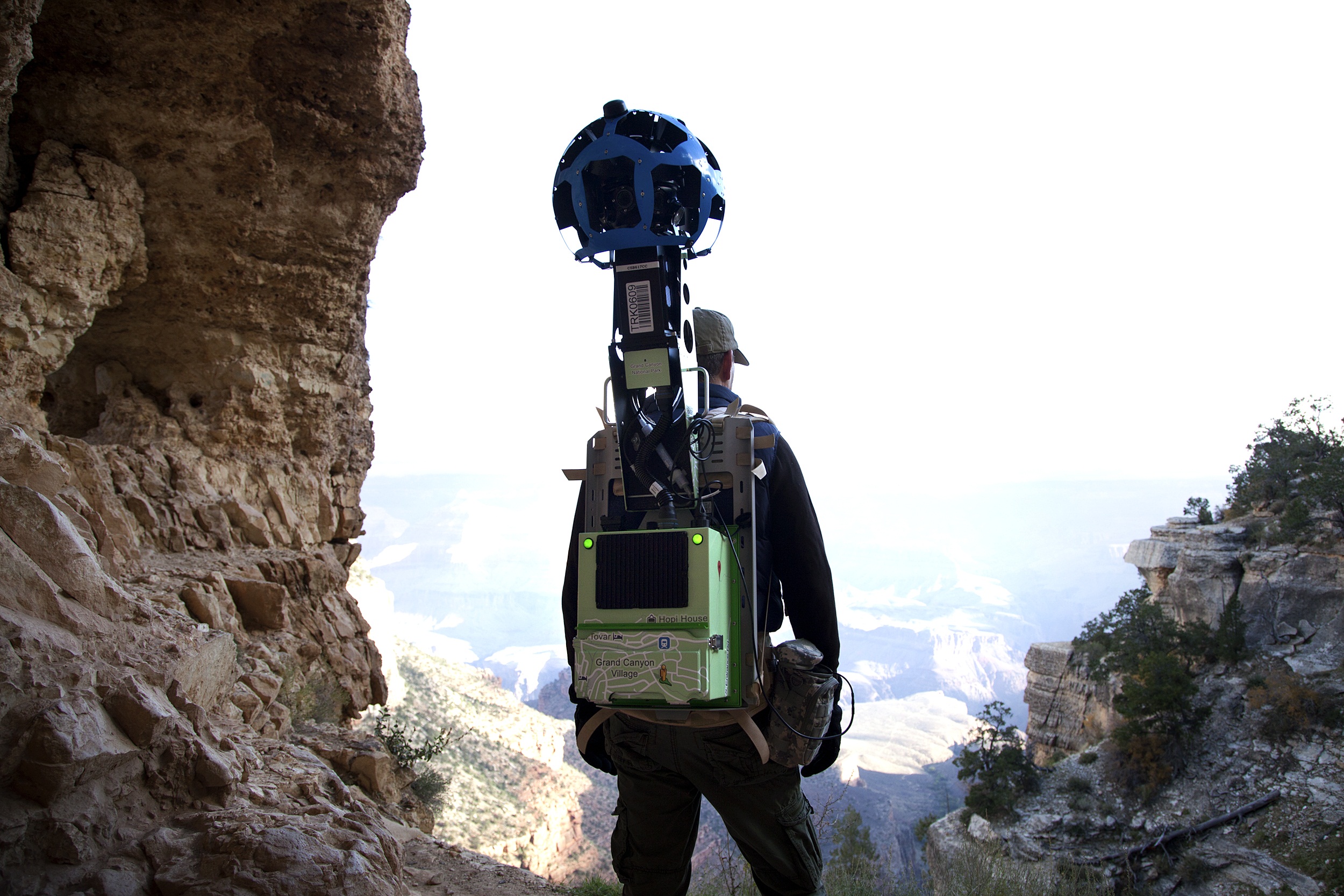
Normally rendered via a camera atop a moving vehicle, Google Maps’ panoramic views won’t have the luxury of a van on pre-mapped streets. A team on behalf of the company will therefore trek on foot with more portable equipment and cameras harnessed to wearable backpacks into trails and paths not accessible in anything but a pair of hiking shoes.
Google began the concept of off-road imagery having recently added detailed images of the Amazon, Antarctica, and a number of ancient ruins and university campuses worldwide.
"The narrow ridges and steep, exposed trails of the Grand Canyon provide the perfect terrain for our newest camera system," Google said on its official blog. "The Trekker – which its operator controls via an Android (News - Alert) phone and automatically gathers photos as he walks – enables the collection of high-quality imagery from places that are only accessible on foot."
Google’s Trekker, according to Wired, is a portable and wearable version of the camera used on its automobiles when shooting street views by road. Fifteen 5-megapixel lenses auto-shoot photo every 2.5 seconds, which the team controls by hand through an HTML5 app on a designated android smartphone.
Google Maps held an event last June exhibiting the technology for use in regions like the Grand Canyon.
“In general this is about making Street View better, but also about creating these ‘wow’ moments,” said Steve Silverman, operations manager on the Google Street View team, shown below wearing the Trekker. “Google is filled with outdoors people. The idea of coming out on the trails was just a logical thing. And again, when you look at Maps – and there is a map of the Grand Canyon – you look at it and say ‘I want to see more.’”
Silverman on Bright Angel Trail. Image via Ariel Zambelich/Wired
Google encourages outdoor enthusiasts to contribute their own preferences for what they’d like to see included in Google Maps’ ongoing development, in a report on Mashable.
The team at present is gathering material from parts of the South Rim at Grand Canyon National Park, as well as the ridge, and both the Bright Angel and South Kaibab Trails.
Edited by Brooke Neuman